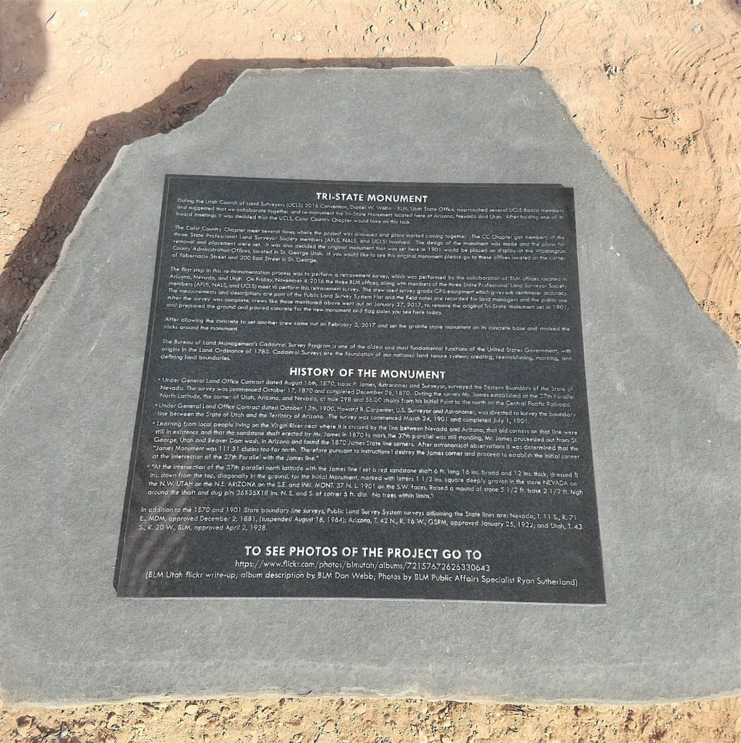
History of the Monument:
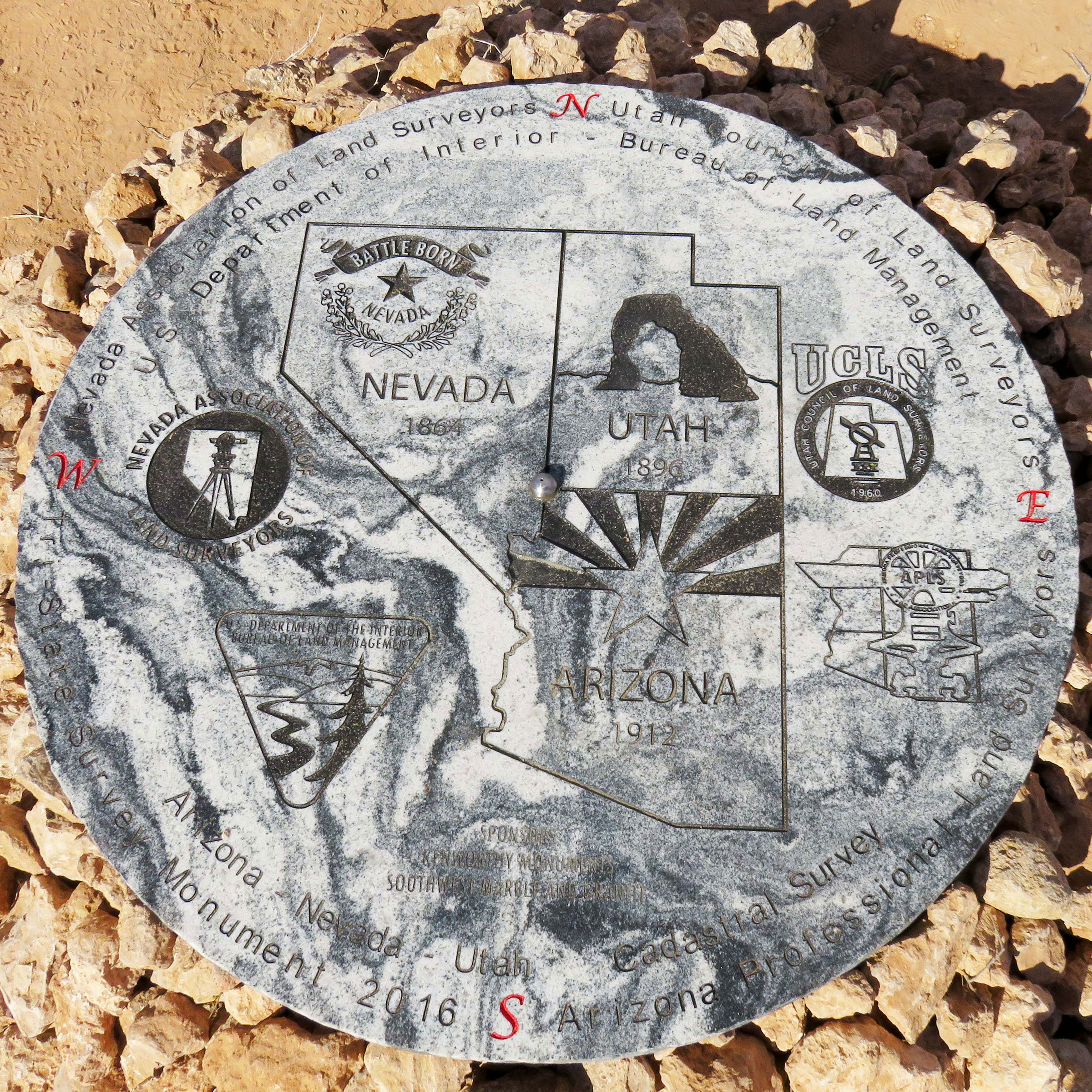
The monument for the Southwest Corner of Utah is a monument for three states — it marks the location of the Southwest Corner of Utah, the Northwest Corner of Arizona, and the East line of Nevada.
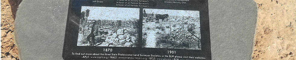
1870 – Under the General Land Office Contract dated August 16th, 1870, Isaac P. James, Astronomer and Surveyor, surveyed the Eastern boundary of the State of Nevada. The survey commenced October 17, 1870, and completed December 26, 1870. During the survey Mr. James established at the 37th Parallel North Latitude, the corner of Utah, Arizona, and Nevada, at mile 298 and 56.00 chains from his Initial Point to the north on the Central Pacific Railroad.
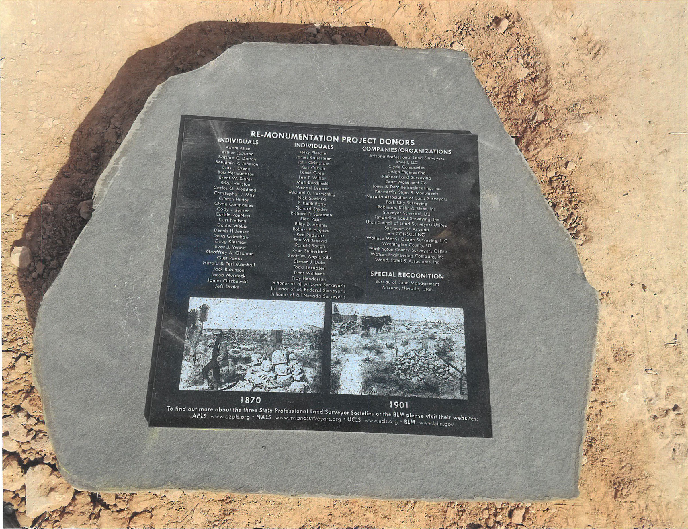
NOTE: This original monument is displayed on the second level of the Washington County Administration Building. The middle portion of the 6-foot shaft was cut off and removed to display both monuments.
1900 thru 1901 – Under General Land Office Contract dated October 13th, 1900, Howard B. Carpenter, U.S. Surveyor and Astronomer, was directed to survey the boundary line between the State of Utah and the Territory of Arizona. The survey commenced March 24, 1901, and completed July 1, 1901.
Learning from local people living on the Virgin River near where it is crossed by the line between Nevada and Arizona, that old corners on the line were still in existence and that the sandstone shaft erected by Mr. James in 1870 to mark the 37th parallel was still standing, Mr. Carpenter proceeded out from St. George, Utah and Beaver Dam Wash, in Arizona and found the 1870 James state line corners. After astronomical observations it was determined that the “James Monument was 111.51 chains too far north (7,359.67 feet or 1.39 miles). Therefore, pursuant to instructions I destroyed the James corner and proceeded to establish the initial corner at the intersection of the 37th Parallel with the James line.”
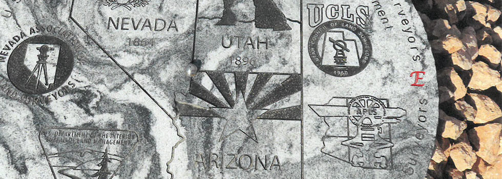
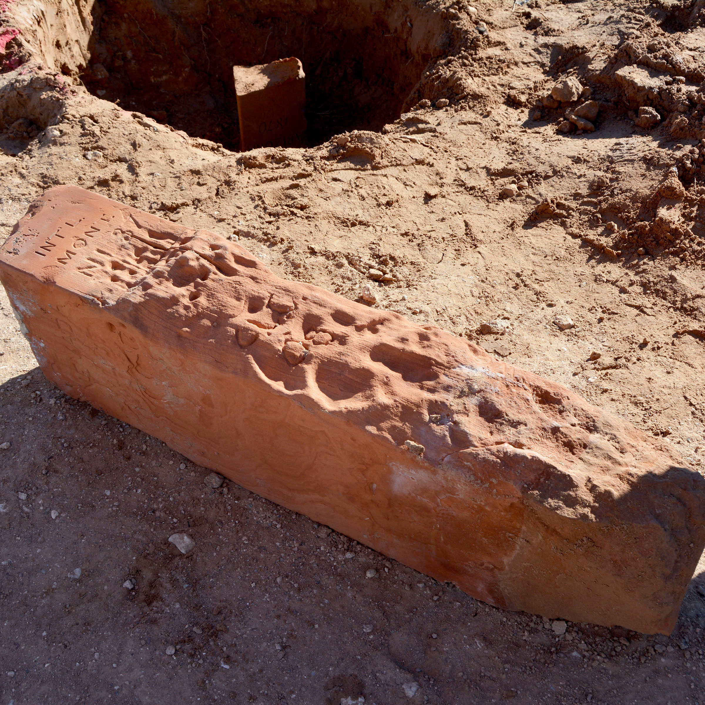
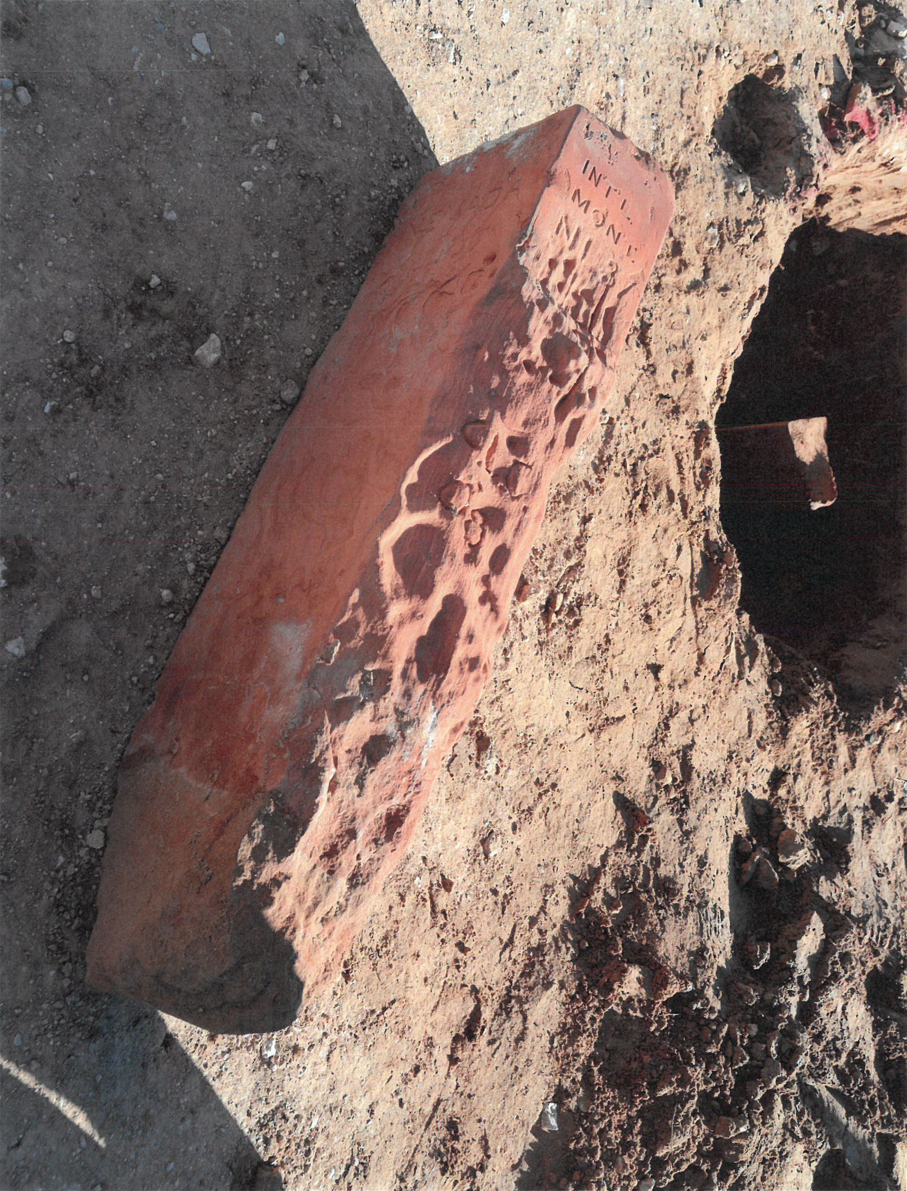
“At the intersection of the 37th parallel north latitude with the James line I set a red sandstone shaft 6 ft. long 16 ins. broad and 12 ins. thick, dressed 8 ins. down from the top, diagonally in the ground, for the Initial Monument, marked with letters 1 1/2 ins. square deeply graven in the stone NEVADA on the N.W. UTAH on the N.E. ARIZONA on the S.E. and INtl. MONT. 37 N. L. 1901 on the S.W. faces. Raised a mound of stone 5 1/2 ft. base 2 1/2 ft. high around the shaft and dug pits 36X36X18 ins. N. E. and S. of corner 6 ft. dist. No trees within limits.”
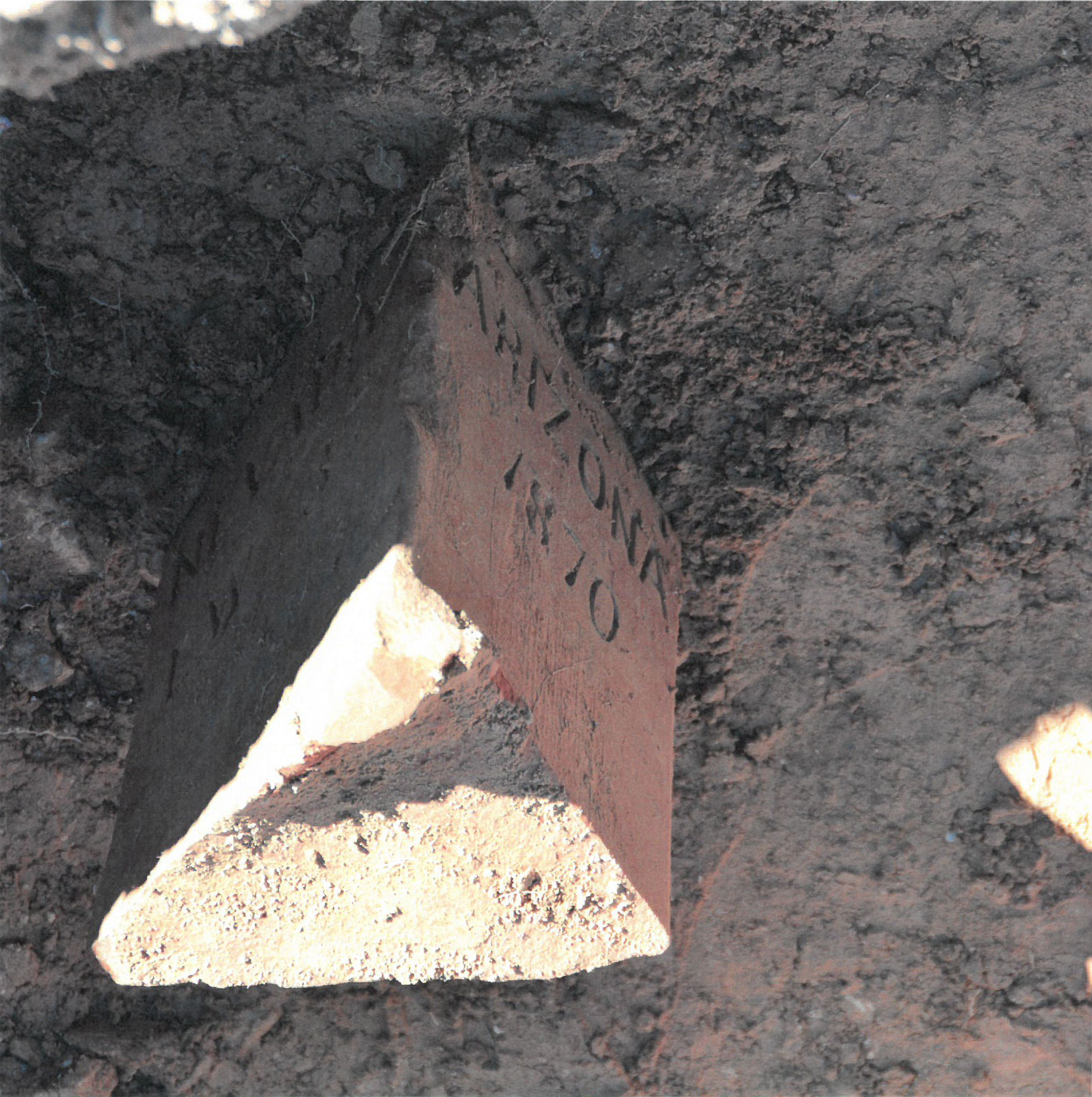
NOTE: Mr. James did not destroy the 1870 Monument like he mentioned in his notes. What he did was invert the 1870 stone shaft into the ground and what used to be the bottom of the shaft became the top of the shaft as he describes being 16 inches by 12 inches and dressed down 8 inches from the top and marked with the lettering.
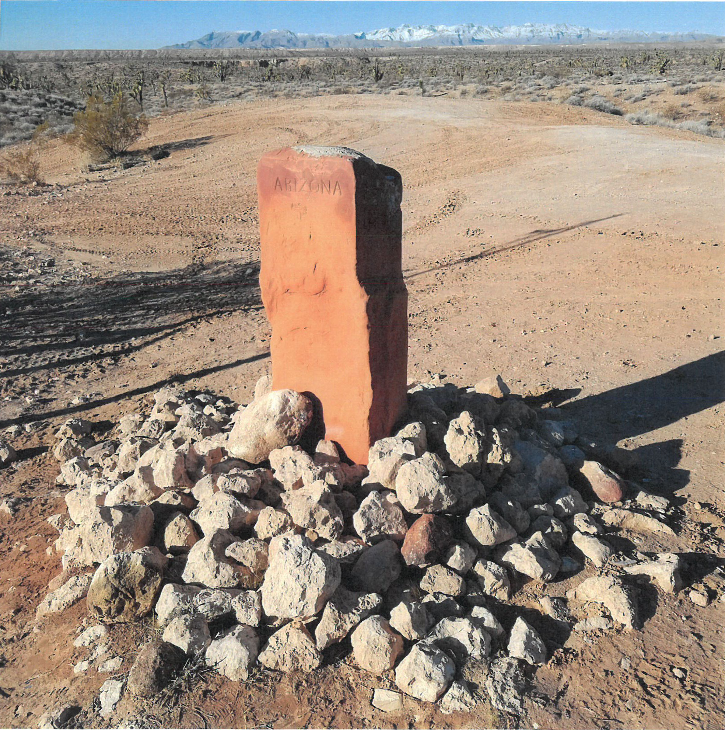
In 2017, the Utah Council of Land Surveyors, in cooperation with the BLM replaced the sandstone monument with a granite monument seen today. The original sandstone monument with 1:70 markings from the other end are on display at the Washington County Administration Building in St. George, Utah.
The 1870 Monument was secured by our late Public Works Director Ron Whitehead. Washington County appreciates Ron’s foresight in preserving this part of history for others to enjoy.
Original Monument (1870 – 2016)
Current Monument (2016 – Present)
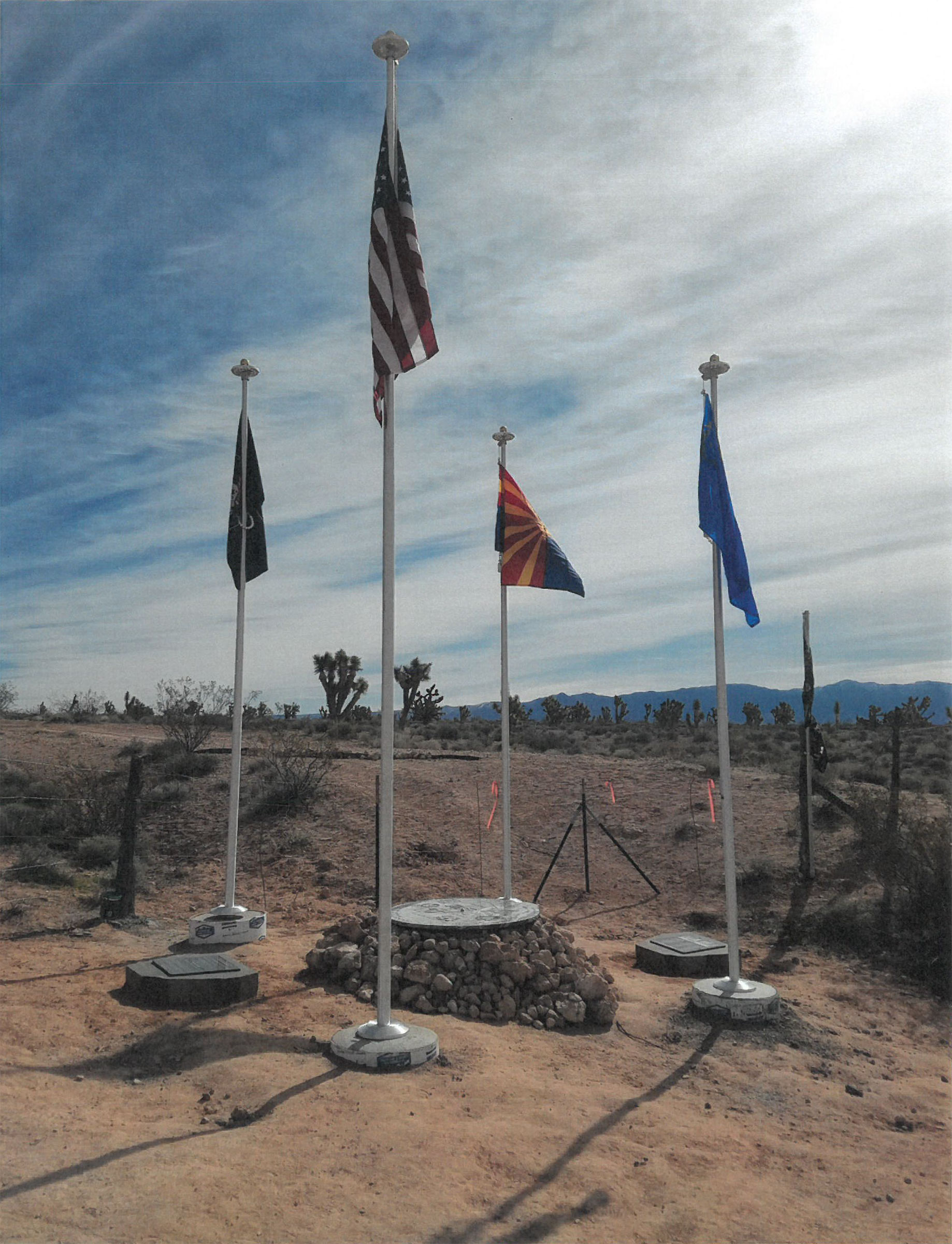
Monument Location
Share this Page